
Key Takeaways
- El Niño increases Atlantic wind shear, reducing — not eliminating — hurricane activity
- Major hurricanes have struck the Gulf Coast during every strong El Niño in recorded history
- Gulf of Mexico storms are least suppressed by El Niño and can intensify in under 72 hours
- Communities that under-prepare during "quiet" seasons suffer disproportionately higher losses
- Shutter inspection, insurance review, and supply staging should happen every June 1 regardless of forecast
Every few years, forecasters announce an El Niño pattern in the Pacific — and almost immediately, coastal homeowners start wondering if they can skip shutter season. The headlines get optimistic. The tone gets relaxed. And that's exactly when complacency becomes dangerous.
What El Niño Actually Does to Hurricane Season
El Niño is a periodic warming of the central and eastern Pacific Ocean that sends ripple effects through the global atmosphere. One of its most significant effects for the Americas is increased wind shear over the Atlantic and Gulf of Mexico — upper-level winds blowing at different speeds or directions that tear apart developing storms before they can organize and strengthen.
According to NOAA's climate research, strong El Niño events can reduce the number of Atlantic named storms by 30% or more compared to neutral or La Niña years. The result is fewer named storms overall, fewer storms reaching hurricane strength, and a compressed active season.
In a strong El Niño year, the Atlantic might produce 10 named storms instead of 18. That sounds reassuring — until you remember: it only takes one storm to change everything.

A quiet Gulf on a clear day offers no guarantee of what September may bring.
The Storms That Didn't Get the Memo
History is full of El Niño years where a single storm rewrote the story for thousands of families. The National Hurricane Center's historical records document major landfalls during nearly every significant El Niño event on record. Here are four that stand out:
A developing El Niño was no obstacle for Opal, which exploded from a tropical storm to a Category 4 in just 16 hours over the Gulf. It hit Pensacola with 150 mph winds and a storm surge that erased beachfront communities across the Florida Panhandle. Damage topped $3 billion.
The 1997–98 El Niño was one of the strongest ever recorded. The Atlantic season was quiet — until October, when Mitch became one of the deadliest Atlantic hurricanes in history, killing over 11,000 people. The season had seemed so calm for so long.
During an El Niño season, Ida struck Alabama and the Florida Panhandle in November — well past when most homeowners had stopped paying attention. It caused significant flooding and storm surge damage across the Gulf Coast when guards were completely down.
A developing El Niño didn't stop Idalia from rapidly intensifying in the Gulf and striking near Keaton Beach, Florida. Steinhatchee was devastated. Coastal flooding reached deep inland across the Big Bend region — one of the quieter predicted seasons in years, one of the most expensive landfalls in recent Florida history.
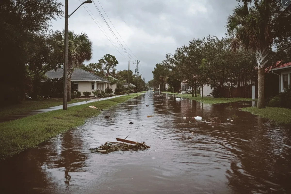
Storm surge — not wind — is the leading cause of hurricane fatalities. El Niño does not lower the Gulf's water temperature.
Source: National Hurricane Center — Storm Surge Overview
Why Gulf Coast Homeowners Face Special Risk in El Niño Years
Here's something the forecasting headlines rarely explain: El Niño's wind shear effect is considerably stronger over the deep Atlantic than over the Gulf of Mexico. That means storms that do develop — especially late-season Gulf systems — can still intensify rapidly even when the broader Atlantic season looks quiet.
Rapid intensification — a jump of 35 mph or more in 24 hours — is not reliably suppressed by El Niño conditions. The Gulf of Mexico retains warm surface temperatures well into October and sometimes November. A storm that looks manageable on Monday morning can be catastrophic by Thursday landfall.
For homeowners in Florida, Texas, Louisiana, Alabama, and Mississippi, this asymmetry matters enormously. The storms most likely to catch Gulf Coast residents off guard are precisely the ones El Niño does the least to prevent.
The Real Risk Isn't the Storm Count — It's the Mindset
Insurance adjusters and emergency managers share a quiet worry every El Niño year: people don't prepare. Shutter sales dip. Evacuation plans get skipped. Generator maintenance gets pushed to next year. People hear "quieter season" and translate it in their minds as "no season."
Then a single storm tracks through the Gulf in late September and finds an underprepared coastline.
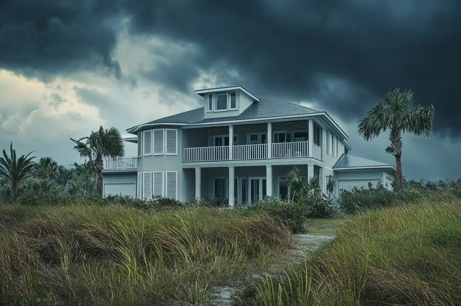
When clouds like these appear, it's already too late to schedule shutter installation. The window is April through May.
What You Should Do in an El Niño Year
The calculus for protecting your home does not change based on Pacific water temperatures. Here is your practical pre-season checklist — the same steps emergency managers recommend every year regardless of the forecast:
-
Inspect your shutters before June 1 Hardware corrodes in salt air. Accordion tracks stiffen. Roll-down motors fail silently. A shutter that does not deploy is no shutter at all — and there is no time to fix it when a storm is 48 hours out. Use our shutter type guide to understand what maintenance each system requires.
-
Schedule your wind mitigation inspection now Insurance discounts for hurricane protection apply year-round — not just in active seasons. A certified inspection can reduce your annual Florida homeowner's premium by hundreds of dollars. It costs nothing to prepare; it costs a great deal not to.
-
Watch the Gulf, not just the Atlantic Gulf storms can develop and reach a coastline in under 72 hours. Subscribe to the National Hurricane Center's free email alerts and set them for both Atlantic and Gulf of Mexico activity — not just the Atlantic basin.
-
Stage your emergency supplies by July 1 Water, medications, documents, and a generator fueled and tested. Check our full hurricane supply list — it covers everything from 72-hour kits to 2-week self-sufficiency for coastal households.
-
Review your homeowner's and flood insurance now Policy renewal windows and coverage gaps are far easier to resolve in spring than in August. Check flood coverage separately — most standard homeowner's policies do not cover storm surge damage, which is the number one cause of hurricane fatalities.
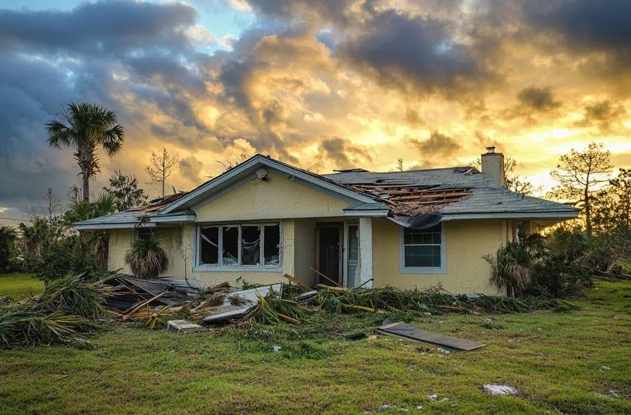
The aftermath of a single storm that "wasn't supposed to happen" in a quiet season.
Frequently Asked Questions
The Bottom Line
El Niño reduces the odds. It does not eliminate the risk. The most expensive storms in Florida and Gulf Coast history include years when forecasters called for below-normal activity. The storms that define a coastline's future don't follow seasonal averages — they follow physics, warm water, and the geography of wherever you live.
Your shutters don't know what the Pacific is doing. Neither does a storm surge.
Find the Right Shutters for Your Home →